The Role of Automation in Disaster Response and Recovery
Automation has become vital to improving recovery and response to disasters, completely changing how we handle these crucial stages. It is more important than ever to have quick, effective, and efficient response and recovery techniques in the face of more frequent and severe natural catastrophes. The disaster management field is changing significantly due to automation in all of its manifestations. Utilizing cutting-edge technology like robots, automated data processing systems, and drones characterizes the incorporation of automation in disaster response. For example, drones are now widely used to inspect regions affected by disasters. They offer real-time data and pictures for estimating damage and organizing rescue activities. Inaccessible to people in the early aftermath of a disaster, this airborne viewpoint enables a quicker and more thorough knowledge of the situation, resulting in a more efficient deployment of troops and resources. Another aspect of automation is robotics, which has enormous potential for use in search and rescue missions. Robots are capable of doing activities that humans would find dangerous or impossible, such as navigating hazardous terrain and entering shaky structures. Systems for automated data analysis are also essential to disaster response. Large volumes of data from many sources, such as social media, sensor networks, and satellite imaging, may be quickly processed by these systems, giving crucial information for decision-making. These systems support effective resource allocation, risk assessment, and catastrophe preparation by identifying trends and forecasting possible outcomes.
Important technical developments have fundamentally changed the emergency response and recovery scenario. We will discuss some automation technologies and their roles in disaster management and response. These Automation technologies increase the efficacy and safety of recovery activities following disasters and boost the efficiency of response operations.
Role of Drones, or Unmanned Aerial Vehicles (UAVs):
Unmanned aerial vehicles, or UAVs, known as drones, are becoming an indispensable part of disaster response and recovery efforts because of their special characteristics, which greatly improve these operation’s success rate. Technically speaking, drones can take precise aerial photos and deliver data in real-time from disaster areas since they are outfitted with high-resolution cameras, infrared sensors, and GPS technology. This skill depends on planning rescue and relief operations, determining affected regions, and evaluating damage. They can access places that are dangerous or inaccessible to human rescuers. They may be used to examine the damaged region after a significant earthquake, finding people buried beneath rubble and marking safe pathways for rescue crews. Drones can evaluate inundated areas, measure the amount of damage, and keep an eye on persistent dangers like dam breaches or secondary flooding following storms or floods. In the recuperation stage, they are quite important. Critical infrastructure, including highways, bridges, and electricity lines, might benefit from their assistance in assessing damage, which can help with planning and prioritizing repair projects. Drones fitted with multispectral sensors may assess crop damage during agricultural catastrophes and direct relief operations.
After the 2015 Nepal earthquake, drones were instrumental in providing vital information for damage assessment and rescue efforts in isolated and mountainous regions.
Role of Robotics and Automated Machines:

Robotics play a vital part in disaster response and recovery because of their sophisticated technical capabilities, which allow them to operate in dangerous or inaccessible locations. These robots, which are outfitted with advanced sensors such as LIDAR (Light Detection and Ranging), thermal imaging, and chemical detection systems, can identify dangerous compounds, navigate through rubble, and identify the heat signatures of survivors. This allows them to provide vital information in real time. These devices automatically assess data and make judgments based on patterns and environmental inputs by using artificial intelligence (AI) and machine learning. This is especially important in circumstances involving unanticipated disasters. To improve the speed and efficacy of search and rescue efforts, artificial intelligence (AI) programs, for example, may intelligently analyze debris patterns to determine possible survivor locations. Many of these robots may also be operated remotely, allowing human operators to direct them from a safe distance. On the other hand, more sophisticated versions can operate partially or autonomously, carrying out activities with pre-programmed objectives and real-time sensor data. Robotic manipulators, also known as robotic arms, come in a variety of styles and sizes. They range from robust models that can move bulky objects to more accurate models designed for precise tasks like cutting or lifting in tight places. To minimize radiation exposure to humans, robotic vehicles fitted with radiation sensors and cameras were used for damage assessment and cleaning in highly radioactive regions after the Fukushima Daiichi Nuclear Disaster in 2011. Similarly, after the 2017 Mexico Earthquake, robots that resemble structures like snakes and are made to maneuver in confined places played a crucial role in finding survivors beneath the debris. These robotics technical advancements—especially in AI, sensor technology, and remote control—can improve the safety and efficacy of disaster response and recovery operations, but they also greatly broaden the range of options available for handling the aftermath of catastrophic occurrences.
Role of Automated Geographic Information Systems (AGIS):
Utilizing their technological capabilities to revolutionize emergency management, Automated Geographic Information Systems (AGIS) have emerged as a key component of disaster response and recovery efforts. AGIS are sophisticated systems that combine data from several sources, such as reports from the ground, sensor data, and satellite images, to provide thorough, real-time geographic maps and analysis. These systems are essential for determining the effects of disasters, organizing rescue missions, and directing rehabilitation activities. The incorporation of real-time data streams into AGIS is a crucial technological component that enables dynamic mapping and condition monitoring. Responders can see the full extent of the crisis by superimposing information about infrastructure, population density, and weather patterns on geographic maps. This expertise is essential for determining the areas most impacted, organizing escape routes, and judiciously allocating resources. AGIS can follow the movements and advancements of rescue teams during response operations, giving them the best paths to go across disaster-affected areas. These technologies aid in damage assessment and rebuilding planning throughout the recovery stages, guaranteeing that resources are directed where they are most required. In risk management, AGIS is also very important since it assists in anticipating potential crisis scenarios and making plans for them. One such instance in which AGIS proved useful was during the 2010 Haitian earthquake. The impacted areas were mapped using AGIS, which provided up-to-date information on the extent of the devastation and the locations of temporary camps, directing efforts to provide international help and rescue. Similar to this, AGIS’s vital information on fire spread during Australia’s 2019 bushfires enabled the efficient deployment of firefighting resources and the evacuation of nearby areas.
Mobile and Communication Technologies:
Due to their ability to provide vital connection and information dissemination during emergencies, mobile and communication technologies have emerged as key components in improving disaster response and recovery. These technologies span a wide variety of devices, from simple cell phones to complex satellite communication systems, all of which are essential for managing recovery operations and organizing rescue activities. The real-time communication capabilities of these systems are among their most important technological features. Cellular networks frequently make it easier for impacted people, relief agencies, and first responders to communicate with one another after a crisis. Mobile networks can be quickly established or repaired, guaranteeing continued communication flow even in the event of damage to traditional communication infrastructures. Additionally important are satellite phones and portable internet devices, particularly in isolated or badly affected locations with non-operational terrestrial networks. Furthermore, mobile platforms and apps have evolved into indispensable instruments for disaster management. They make it possible to coordinate relief operations, track locations, and share information quickly. Apps can give users access to emergency services, transmit alarms, and give information on evacuation routes. For instance, smartphone applications played a major role in assisting with evacuations, following the route of Hurricane Irma in 2017, and delivering notifications.
Role of Wearable Technology and Biometrics:
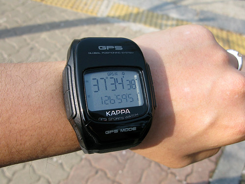
With the ability to provide vital insights and improve operational safety, wearable technology, and biometrics are becoming an increasingly important part of the automation landscape in disaster response and recovery. These automated devices, which have different functions in emergency scenarios, vary from fitness trackers and smartwatches to more specialist equipment like biometric sensors and augmented reality (AR) headsets. First responders’ vital indicators, such as body temperature and heart rate, may be tracked by wearable devices with a range of sensors, assuring their safety in demanding situations. GPS-enabled wearables make Real-time position monitoring possible, which is essential for organizing rescue operations and controlling personnel movements in disaster-affected areas. For example, firefighters utilized wearable GPS devices to navigate over dangerous terrain and intense smoke during the 2018 California wildfires. In contrast, biometric technology is essential for security and identity management in disaster relief efforts. To help with reunion efforts and stop identity theft, fingerprint scanners, iris recognition software, and facial recognition technology can be used to identify victims and survivors. These tools help retain accurate records for future assistance and analysis and guarantee that relief reaches the right folks in the chaotic aftermath of disasters. Responders’ situational awareness is improved with augmented reality equipment, such as AR goggles and helmets. They can help with navigation and decision-making in complicated circumstances by superimposing important data, such as building layouts or hazard locations, over the actual picture. The use of wearable technology in disaster relief was evident following the 2011 earthquake and tsunami in Japan. Wearable cameras were utilized by the rescue personnel to record and evaluate the damage, giving important information for recovery plans and future preparedness measures.
Case Studies Regarding the Role of Automation in Disaster Response and Recovery:
2017 Drones for Evacuation and Assessment Amid Hurricane Harvey (USA):
Hurricane Harvey was one of the most destructive natural disasters in American history. Emergency crews used unmanned aerial vehicles (UAVs) to map flooded regions, find trapped people, and evaluate the structural integrity of structures. Drones were important in the damage assessment process. Drones fitted with cameras and heat sensors provided real-time data, which allowed for safer rescue operations and more effective resource allocation.
2020 Beirut Port Explosion (Lebanon):
Robots in Search and Rescue: In the wake of Beirut’s devastating explosion, robotics were used to conduct search and rescue missions amid the debris. To search for survivors and evaluate structural damage in regions too hazardous for human rescuers, remote-controlled robots were deployed.
AI and IoT for COVID-19 Global Pandemic Tracking and Reaction:
AI and IoT were heavily utilized during the COVID-19 pandemic to track the virus’s path, examine infection trends, and manage hospital resources. Wearables that monitor temperature, AI-driven prediction models, and automated contact tracking applications all contributed significantly to the worldwide pandemic response.
2021 European Floods:
Drones and Automated Alert Systems for the 2021 European Floods Automated alarm systems were essential in enabling populations to evacuate in time during the devastating floods that ravaged Western Europe, especially in Germany and Belgium. Drones were widely utilized for damage assessment in flooded regions to assess the structural damage to infrastructure and assist rescue personnel in determining safe paths to reach trapped victims.
2021 Pacific Northwest Heatwave – Internet of Things for Tracking and Reaction:
IoT devices were used to monitor temperature swings and trigger alarms in locations with sensitive populations during the record-breaking heatwave. By controlling the rising power demand, smart grids helped avoid blackouts at crucial moments.
2020 Cyclone Amphan (Bangladesh and India) – AI and Satellite Data for Prediction:
AI and satellite data were used to forecast Cyclone Amphan’s route and strength precisely, which is one of the strongest cyclones ever to impact the area. By using automation technology, officials were able to carry out focused evacuations, which reduced the number of fatalities. To distribute relief efficiently after the storm, satellite photography was utilized to determine the extent of the damage.
Conclusion
In conclusion, automation is playing a deeper role in disaster response and recovery, changing the way we deal with the fallout from major events. The area of emergency management has seen a transformation thanks to the incorporation of cutting-edge technologies, including wearable technology, drones, robots, Automated Geographic Information Systems (AGIS), and mobile and communication technologies. These technologies guarantee a more effective, safe, and efficient management of catastrophe scenarios and enhance human rescuers’ capacities. With their ability to perform airborne surveillance, drones, also known as unmanned aerial vehicles or UAVs, have become indispensable instruments for damage assessment, search and rescue missions, and disaster zone mapping. They offer real-time data, which is quite helpful for making prompt, well-informed judgments. Robots with artificial intelligence (AI) and sophisticated sensors are revolutionizing search and rescue operations, especially in dangerous areas for people. They have proven useful in several recent tragedies, such as the nuclear accident at Fukushima Daiichi and the explosion at the Beirut port, exhibiting their capacity to function in harsh environments while guaranteeing the protection of people. AGIS technology is an effective tool for mapping the effects of disasters and supporting the efficient planning and allocation of resources. AGIS assists Responders in comprehending and navigating the intricacies of disaster-affected areas, which offers comprehensive geographic data and analytics. When catastrophes strike, mobile and communication technology plays a critical role in keeping multiple stakeholders connected and coordinated with real-time health monitoring and improved situational awareness. Wearable technology and biometrics have improved responders’ safety and operational effectiveness. It is obvious that as time goes on, the automation of disaster management will continue to develop, bringing with it fresh methods and solutions for dealing with crises. In this article, we also discussed some of the recent disasters and the role of automation in the response and recovery. To meet the difficulties posed by increasingly frequent and severe disasters, these technologies must continue to be developed and refined. By utilizing automation, we may become more resilient and ready to face problems in the future, as well as more capable of responding to and recovering from calamities.
DO Supply Inc. makes no representations as to the completeness, validity, correctness, suitability, or accuracy of any information on this website and will not be liable for any delays, omissions, or errors in this information or any losses, injuries, or damages arising from its display or use. All the information on this website is provided on an "as-is" basis. It is the reader's responsibility to verify their own facts.